I regularly walk with a number of Rambling Groups - and have regained much of my fitness since the years of inactivity in my late 50's whilst working.
The Ramblers also give me the opportunity to walk with a group of like-minded people, midweek so as to leave the weekends free for other things.
This last week, I got out with the East Cheshire group to do a loop of the summits east of Macclesfield - taking in Three Shires Head, Danebower Quarry, Whetstone Ridge, Shining Tor and Shutlingsloe. The weather was extremely windy and then more so!!
24Feb15-Three%2BShires%2BHead.jpg)
On the bridge at Three Shires Head - plenty of water flowing down
24Feb15-crossing%2BRiver%2BDane.jpg)
Crossing the River Dane at Danebower Quarry - the river was well over the stepping stones!

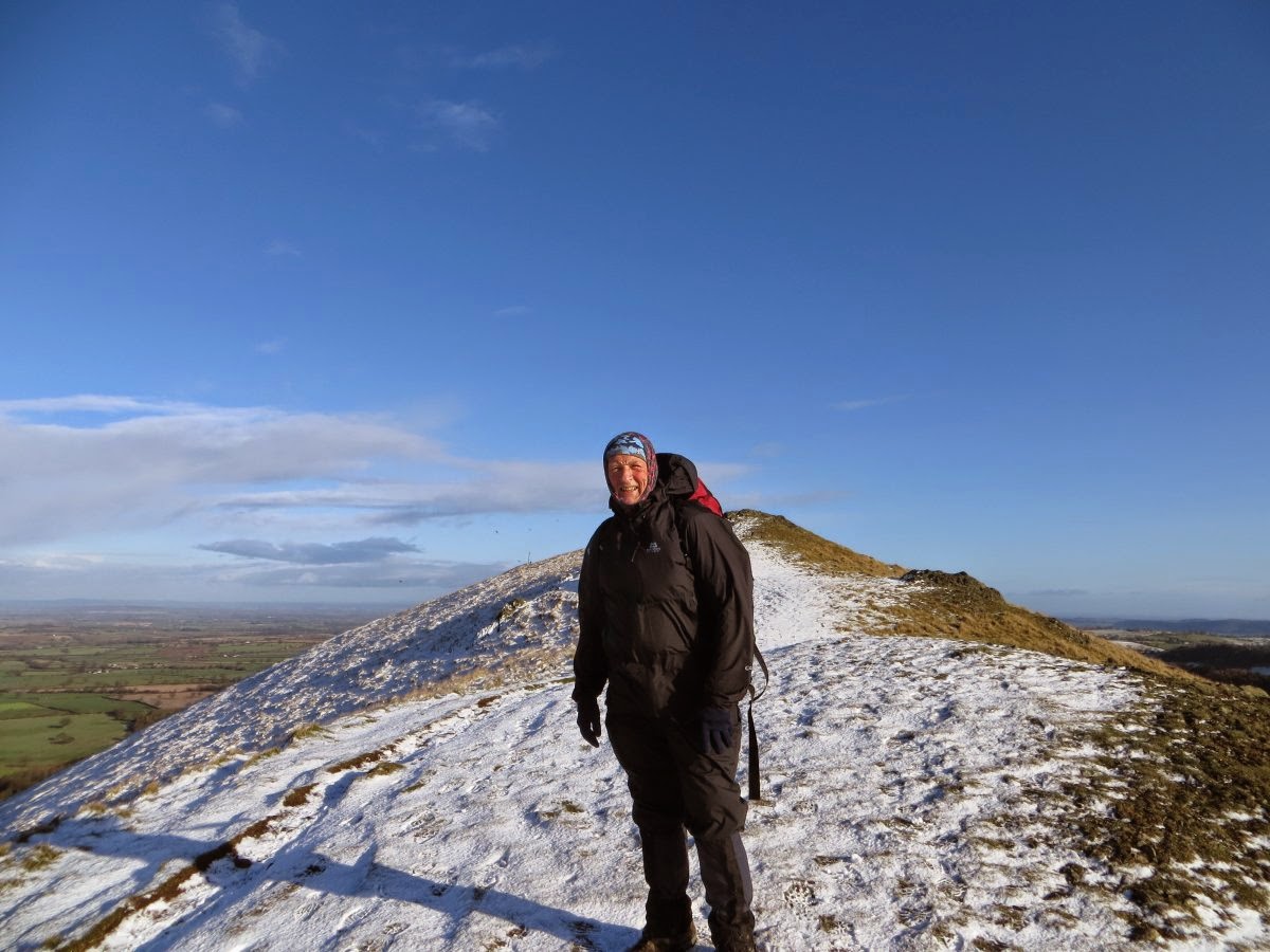
The view north from Whetstone Ridge, near the Cat and Fiddle, at 547m (1794ft) it is the second highest summit in Cheshire
24Feb15-Shing%2BTor.jpg)
Next was the highest summit in Cheshire of Shining Tor at 559m (1834ft) - and it was blowing a gale !
You can just see Shutlingsloe in the distance on the left - where we are heading ...
24Feb15-Shutlingsloe.jpg)
We used the permissive path down through Chest Hollow off the Buxton Road to gain Wildboarclough and the ascent up through Macclesfield Forest.
The photo is of the top of Shutlingsloe, third highest summit in Cheshire at 506m (1660ft)
This was a 'hard' walk made much harder by the cold, gale force winds.
We covered 12.6 miles and climbed 2520 feet.
A few days later, I made the car drive over to Grindon in the Staffordshire White Peak to join the walk of the North and Mid Cheshire Ramblers. The weather was wet - very wet and the ground absolutely sodden, and muddy, and slippy!!
This is an area I don't know, so the route was of much interest to me.

Ready to set off at 9.45am - and it's belting with rain!

Taken at the top of Ecton Hill 369m (1211ft)

Looking at the descent of Ecton Hill - a significant industrial location for copper and lead mining. Owned by the Duke of Devonshire - the mine was the richest in the country in the late 18th Century - the profits said to have paid for the building of the Crescent in Buxton!

Crossing a fast flowing stream - with wobbly stepping stones!
Our leader for the day adapted the route to avoid deep mud in low fields and an impassable stream! We walked about 9.5 miles (which is modest by this group's standards) and climbed 2076 ft. However, it felt much harder given the slippery and heavy underfoot conditions!